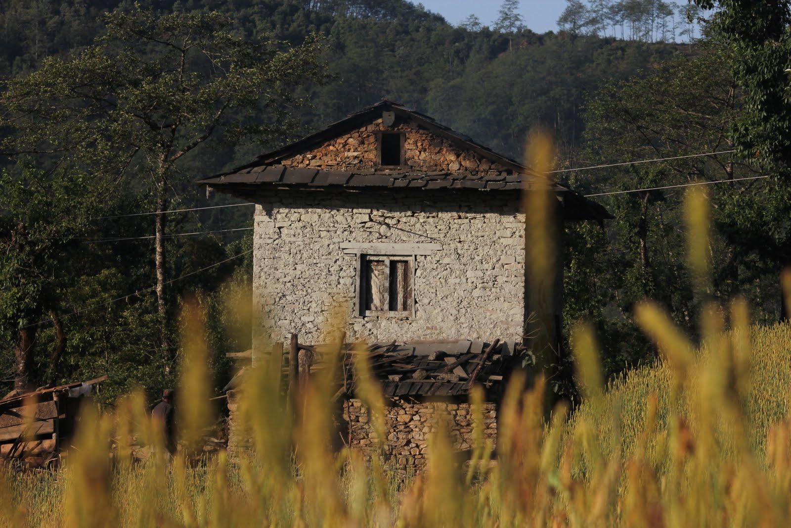
We thoroughly enjoyed our time in Namche Bazaar. We stayed at a nice hotel (nice by our standards at the time, $2.70/night by another standard) which had an amazing shower that pumped legitimately hot water. That shower was magical. It felt even better nine days later when we arrived back in Namche, but at the time it was still pretty good.
I cleaned the wounds on my hand and legs and put on some anti-bacterial solution. On our first night in Namche, as we all sat around a table getting drunk on Everest Lager (it doesn't take too many at 3500m), I joked that I was lucky I didn't fall in yak shit, because that might have complicated my injuries. The next morning, freed from the beer and altitude-induced haze, I began thinking "maybe I did fall in yak shit. Who knows?" I put on some Neosporin and took an antibiotic. Couldn't hurt, right?
We met a few Danish girls and were going to head out with them (a nice trade for the American girls we'd been carrying--literally carrying--along) but we ended up being lazy and staying in Namche an extra day while they headed out a day before us.
We all went out and grabbed some extra gear. I bought an extra set of thermals and a pair of gloves. Yes, I ventured into the Himalayas without gloves. Stupid. But that's not the point right now. I bought a pair.
We also stocked up on a few candy bars and granola bars, the kind of trekking fuel we'd need to climb to 5500 meters.
We awoke early on the day of our departure and went about the unnecessarily complex matter of figuring out the bill at our hotel. Eran, our resident negotiator/bill collector started getting frustrated that nobody was ready. We were all (especially Colin) just being really lazy that morning and sluggish to get moving.
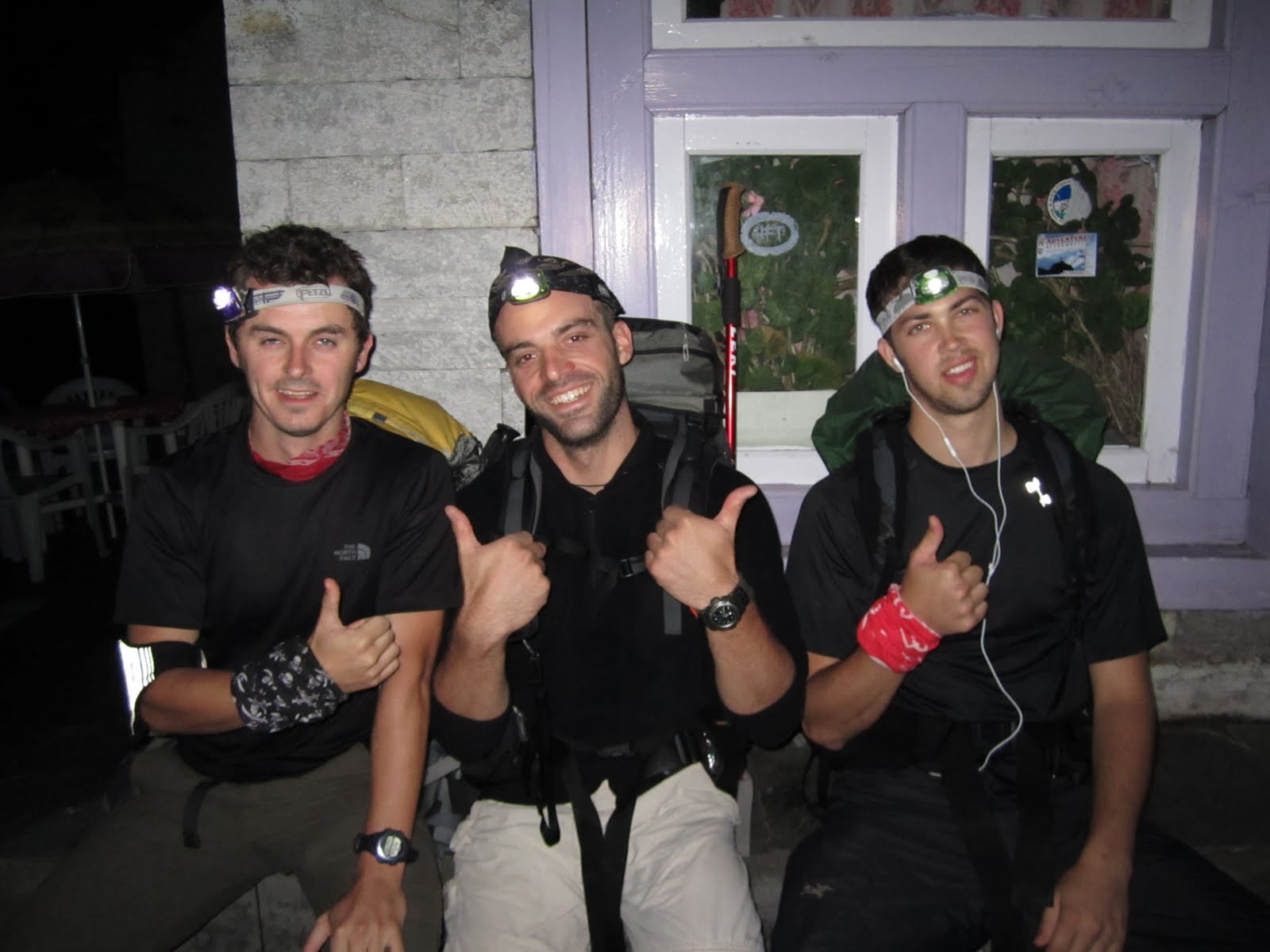
We added a new member to the crew, another guy named Dan who we came to call Griggsy. Griggsy was a tall, skinny, bearded Englishman with a light cockney accent who had a dry, sarcastic sense of humor. Never complaining, always enthusiastic, he was a fun and welcome addition to the group.
Since Eran was fuming and Griggsy was ready to go, the two of them set off for our next destination, Tangboche.
We were in no rush, particularly because the hikes above Namche were considerably shorter in time than what we were used to. However, rather than push on, it was important to limit our hikes to only a few hours a day, to compensate for the altitude.
Climbing in the Himalayas is very different from most other locations in the world. There is no escape from the altitude. If you develop symptoms of AMS, HAPE, or HACE (Acute Mountain Sickness, High-Altitude Pulmonary Edema, High-Altitude Cerebral Edema), it's not as simple as 'descend.' It takes several hours or sometimes days to descend 1000m in altitude. So it was very necessary for us to monitor our health and limit our climbing.
*Fun fact: Viagra, Cialis, and other boner medications mitigate symptoms of Pulmonary Edema. Modern medicine does not yet know why.
After Namche, we kind of went off-book. What I mean is that we had been using the Lonely Planet Trekking Guide up until Namche, but afterwards we made our own schedule. We were definitely better acclimatized and in vastly better shape than 99% of the people on the hill (save for those people there to actually climb things like Everest, Lhotse, Nuptse, Ama Dablam, and Lobuche Peak) so we made our own schedule. The book called for a 16-day schedule, we completed the full trek and summit of Kala Pattar in only 10. This may seem to run contrary to what I said in the preceding paragraph, but we were all very attuned to what our bodies were trying to tell us and in excellent shape (no that's not naivete, it's the truth of the situation).
So we took a few hours that morning to enjoy a final snack from our favorite bakery, packed our bags, and set off for Tengboche.
Day 10: Namche Bazaar to Tengboche
4 hours, 350 meter descent, 750m ascent
By the time we left, a thick layer of clouds had rolled in. We followed a meandering path that wrapped around the valley for about an hour, until it dropped to a steep downhill. Right about then, it began to pour. We dropped our packs and scrambled to get into our rain gear, but by the time I had my jacket on and the rain cover over my pack (the priorities), my pants had become soaked. I still put on my rain pants but it made for a very unpleasant climb to Tengboche.
We descended all the way to Phunke Tenga, the settlement at the valley floor where we'd begin our ascent to Tengboche. We wandered into a teahouse because it was running a dung-powered stove and we wanted to enjoy the warmth and try to dry off a bit before ascending. We got some tea, some soup, and a cheese sandwich. We polished off our water and dropped a few iodine tablets into our refilled Nalgene bottles. I had stopped carrying two liters of water and instead had resorted to only carrying one. It saved me a kilogram that I didn't have to carry and we had adopted a new hiking policy for speed and proper water consumption. We stopped every 30 minutes for a water break and drank 250mL. That's a liter of water per hour, and within an hour we invariably were able to find a water source to refill. Since iodine tabs take 30 minutes to sterilize water anyway, it didn't make sense for me to carry two liters anymore.
We crossed the river at the bottom of the valley and began our ascent. It was an extremely tiring climb, as our destination was over 3800m (12,467ft). The rain lifted and was replaced with a dense fog that made the climb all the more miserable. We were sweating bullets inside our rain gear, and the humidity outside made it worse. We eventually stopped and took off our rain jackets, but for the sake of time and so I wouldn't fall behind Dan, Wim, and Colin, I decided to leave my rain pants on. Not the most comfortable thing in the world.
I can't seem to remember exactly how long it took us to ascend to Tengboche, but once we did we dropped our packs and changed clothes to let some of the gear dry next to the dung-powered stove in the guesthouse we were staying in that night. The sky was a dull grey, and we walked across town (less than a 1 minute walk) to a giant sign that read, 'BAKERY.' We already missed our Namche hangout, but this bakery wasn't nearly as good. We enjoyed a warm tea and rested.
A few minutes later, Eran walked in. He sat down and informed us that the clouds were breaking and we should probably step outside and check out the view. I walked outside and was astounded and pissed off all at once. Astounded because the view was incredible and pissed off because we spent a miserable hour to two hours climbing in a dense and humid fog when all the while we could have enjoyed fantastic scenery instead. Colin ran back to the room and grabbed the camera and the 180mm lens and we started shooting.


We managed to catch our first glimpse of Everest as it poked through the clouds down the trail. It was only for a second, and it was again obscured from view. I'd post the photo we took of it but it looks like shit. It was meaningful to us because we could finally see the target, but it's a terrible photo.
That night we met a few members of a Swedish climbing expedition to Lobuche Peak. They were very friendly and very helpful, as was their climbing Sirdar, Ang Dawa. They often gave us advice on AMS symptoms, acclimatization techniques, and routes and places to stay, much like Ngima Sherpa had done for us in our first 7 days.
After dinner we went upstairs and hit the sack. That night, I awoke to Colin moaning and in obvious pain. He began vomiting and got terrible shits. He asked for antibiotics, but I refused to give them to him until we were sure he wouldn't vomit them up. We had a very limited supply. I gave him some ibuprofen instead and he waited out the nausea. After a few hours, he and I both fell asleep again.
We awoke the next morning and Colin felt a lot better, but certainly not 100%. When the leader of the Swedish expedition heard that Colin was ill, he suggested that Colin stay an extra day in Tengboche in case he was experiencing symptoms of AMS.
Several of us offered to stay behind with him, including myself. I almost felt an obligation to stay behind because he had done the same for me, and because Colin would be the first guy to drop everything to help out any of the other team members if they were sick. Colin refused to let the group fall behind, and explained to me that I absolutely shouldn't stay back because it was a completely different situation than the one I had been in. I needed to climb to Dingboche to better acclimatize, and the group would be putting itself in jeopardy of AMS if we all altered our schedule.
Wim offered to stay behind and Colin reluctantly accepted his offer. Wim hiked that day with us--without his pack--to an altitude of about 4200 meters (13,779ft), before turning back and hiking back to Tengboche. Many climbers use the technique of 'climb high, sleep low' to aid in their acclimatization. Although there is no medical evidence to suggest that it does anything, many climbers swear by this technique. At the time, I didn't really buy it either. After Lobuche, I was a believer.
Day 11: Tengboche to Dingboche
3-4.5 Hours, 70m descent, 580m ascent
As we exited the guesthouse, we looked up to see our first view of Everest. It had been obscured the day before, but we could finally see it. We were thrilled.
The trail to Dingboche begins with a short descent to the river in the valley before you cross a small steel bridge (replacing the sketchy old wood/rope bridge below it) and make a long, slow ascent of 580 meters (1,902 feet).
After the bridge, the trail slowly wound its way uphill to Pangboche, where we stopped for lunch because we saw a shop that said, "Bakery." There seems to be a pattern here. Some of the guys got some pastries and other goodies but I was feeling the need for a carb binge so I ordered some macaroni. It turned out to be the best macaroni in all of Nepal. Macaroni is a very common dish served in the guesthouses, and it's usually stuff that would make Chef Boyardee cringe. Not the Pangboche Bakery, absolutely not. Little chunks of tomato, onion, basil (fuckin basil?!) made it the best thing I ate over the course of the whole trek. The following day, Colin and Wim would stop and order it on their way to Dingboche, and everyone stopped and ordered it on our way back to Kathmandu after Everest.
After lunch, we headed onwards and upwards to Pheriche Pass, where the trail splits. It was about 1pm, and Wim turned around to head back to Tengboche. Someone asked me a question about our current altitude, and I said that I didn't know but that we had to be nearing the tree line--the altitude at which trees are no longer able to grow. We looked around and saw no trees. We looked at the mountain adjacent to us and saw the trees stop a few hundred feet below us.
"I guess we already passed it," someone said.
At the Pass, the trail splits between two towns, Pheriche (for which the pass is named), and Dingboche. Pheriche sits in a valley just south of the Khumbu Glacier, the monster that splits Everest from Nuptse, passes Everest Base Camp, and cuts a swath through the entire valley. Dingboche sits nestled in its own valley, right at the base of Ama Dablam, 130 meters higher than Pheriche. Because of its higher altitude (better for acclimatizaton, as long as we weren't crossing our bodily threshold within that 130m span), we opted to stay in Dingboche.
We climbed again through a haze of fog when all of a sudden it began to snow. Down valley, it was raining. We realized it was a whole new ball game from then on. The wind whipped towards Dingboche and up the valley, pushing the puffy cumulus clouds along with it. They passed right by us, at eye level.
Upon our arrival, we walked inside to warm up, dropped off our packs, and got some tea. A man named Ngima Sherpa was running the lodge (not to be confused with the Ngima Sherpa we met a week prior, and who was no longer on our trail), and he was very kind and hospitable. He had a rough cough, which he called the 'Khumbu cough.' The 'Khumbu cough' is a cough developing from the dryness and altitude at 4,000 meters. The lungs prefer a bit more humidity. It's a truly inhospitable environment that looks more and more alien as we ascended.
I began to get a headache (one of the first symptoms of AMS), but continued to hydrate and it went away.
Day 12: Acclimatization Day, Dingboche
4,410 meters, 14,468 feet
We tried to sleep in a little bit, but by now our bodies were so used to falling asleep at sundown and waking up at sunrise that we all were up before 7am.
After talking with Ang Dawa and the Swedish Expedition, we decided to climb the mountain behind Dingboche that stood at 5100m (16,732ft) as an acclimatization foray. 'Climb high, sleep low.'
I decided to join, but my headache had returned and seemed to be getting worse. I climbed up a good 100 meters or so, but decided to stop there. I had a good view and didn't feel like exerting myself with a headache brewing.
I sat up there for about 30 minutes or so before I decided to descend. Got plenty of great photos of Ama Dablam, Dingboche and the valley, as well as 6100m Island Peak.
I decided to walk around town a little bit, not that it's a particularly exciting or time-consuming activity. The town is possibly smaller than Tengboche, although it's more spread out in farming plots. They actually had an internet cafe, which surprised me, and I went in to check my email. It was pricey to say the least, 500 rupees for 30 minutes of internet, but I guess that's warranted given the extreme isolation and the fact that some poor bastard had to carry the computers, wiring, and equipment all the way up the fucking mountain.
Sherpas are fucking supermen. They are some of the nicest, most hospitable people I've come across on 6 continents. They work incredibly hard for pennies, and they always seem to have a smile on their faces. At one point, we came across a Sherpa who was carrying an 86kg load up a mountain (189 pounds). The way the straps function is that all the weight is placed on the head/neck area. They probably lose several inches of height over a lifetime through spinal compression, and they're short to begin with. They work as porters, eventually becoming base camp porters, and later on climbing sherpas, where the good money is. It's an extremely difficult life, and for climbing Sherpas, incredibly dangerous. More than 50% of all deaths on Everest are Sherpas. The median age in Nepal is only 20 years old. I have nothing but respect for them.
Anyway, I checked my email, found out Osama was dead (Obama 1, Osama 0), and other than that not too much. My headache continued to get worse. I went back to the guesthouse to try to hydrate a bit more and sleep it off.
I couldn't really sleep. When you get up to those altitudes, people tend to have trouble sleeping. As your body relaxes, your respiration slows, and eventually you're not getting enough oxygen. You wake up with a suffocating feeling. It's unpleasant. But it didn't last long for me, fortunately.
My headache worsened and worsened, and eventually it was absolutely head-splitting. I got some dinner, and went back upstairs for the night.
Day 13: Dingboche to Lobuche
4.5-5 Hours, 550 meter ascent
At this point on the trip, everyone was nursing some kind of nagging injury. Blisters, tweaked ankles, knees, whatever. Just about everyone had a blister or two, and several of us were taping ankles and knees before hikes. Some of us had developed coughs, persistent headaches, or other illnesses. On the hike to Lobuche, several mistakes were made that put the team's schedule and summit of Kala Pattar in jeopardy.
In Dingboche, the trail splits again. You have the option to either climb up 100 meters or so, and take a low pass to the town of Dughla, before a steep ascent to Lobuche, or you can take a high pass called the Kongma La, which deposits you at Lobuche.
The book cautions against making climbs of more than 500 meters in a day, and recommends an overnight stop in Dughla. Fuck that, we're walking all the way to Lobuche.
I was feeling great. My headache was gone, and aside from all the cuts and bandages, I felt in perfect health. My acclimatization seemed to be doing well, and after day 13, I think I became the strongest in the group. Maybe some of my teammates would dispute that claim, but I was the first to summit on day 15.
Griggsy and Wim decided to take the Kongma La pass, while the rest of us declined. They set off early in the morning, because the steep climb to 18,159 feet would take an additional 2-3 hours.
The rest of us prepared to set off around 8am or so, but Colin wasn't quite ready to get going. He told us to leave and that he'd catch up, an idea I wasn't too keen on. He was strong, but I doubted his ability to catch up with us at 5000 meters. He was insistant, so I figured maybe he just wanted a little time to hike alone, something I understood completely. Fearing he was going to get lost, I double-checked to make sure he knew the route. He insisted he did.
We set off with a new teammate that day. The day we arrived in Dingboche, we met a nice American guy named Michael Martin. He and I had an odd connection in that his cousin is one of my little sisters' best friends at University of Michigan. Small world. But it was nice to have another American in the group, particularly one that doesn't give Americans a bad name. I think I've gotten sensitive to the issue while abroad, that Americans don't have a great image, and I've tried to be a good ambassador.
Anyway, he was another welcome addition to the group, and we made our way towards Dughla. We got some more great views along the way.
We continued towards Dughla, and made it there in under two hours, way ahead of schedule. About 30 minutes out, and out of nowhere, a storm blew in. The temperature dropped, the valley became enveloped in a thick layer of clouds, and it began to snow and hail. We stopped and pulled out some more appropriate gear.
Eran was moving a bit slowly, and when we arrived in Dughla, he said he was going to stop there. We told him he should join us and ascend, but he said he was having difficulty with the altitude and wanted to rest up in Dughla. He said he'd wait a few hours for Colin to arrive before heading up to Lobuche. We agreed that was a good idea so Colin wouldn't have to walk the whole way alone. Mike, Dan, and I purified some more water and turned to face the huge hill up to Lobuche.
At the top of the hill, it was a little more of a gradual ascent to Lobuche, which we all appreciated. The clouds had also blown completely through and we got some more great views. We also got to see the Chorten erected for Scott Fischer, one of the guides that died on the disastrous May 1996 Everest Expedition.
As we neared Lobuche we realized the alien landscape we were entering. Rocks and ice were everywhere. There was no vegetation. There was 50% of the oxygen there is at sea level. Strange creatures made noises from within crevasses and underneath rocks and boulders.
We rounded a corner and found Lobuche, settled at 4,910 meters (16,108ft). We went to the guesthouse recommended by Ang Dawa and the Swedish Expedition, but found it too pricey. We found another place more comfortably in our price range. We got some food, some water, and relaxed while waiting for the rest of the team to arrive.
Colin and Eran arrived after a little while, and Colin looked completely wasted. His eyes were sunken, his face was pale, and he was completely exhausted. It turned out that he had accepted some extra weight from Griggsy and Wim so they wouldn't have to hump it over the Kongma La Pass. Then, after departing Dingboche, he had taken the wrong path.
In all of our time trekking, the policy had been, "if you're unsure of the path, take the one that goes up." This policy had helped us all the way along and had always been correct, but in this case it steered Colin the wrong way. He had asked a Sherpa for directions, and the Sherpa cautioned him to not take the low path which would lead him to Pheriche, down in the valley. Not being able to see it, and mistaking the road to Dughla as the low path, he headed up towards Nangkartshang Gompa, a nearly 17,000 foot peak. Nearing the summit, and seeing the proper path below him, he was forced to descend and begin the hike from where he started. The tremendous amount of energy he expended on Nangkartshang Gompa would cost him.
Shortly after he arrived, we got word that Wim and Griggsy had arrived as well, and were holed up at a nearby guesthouse getting some food. When I walked in, they looked completely wasted as well. Wim looked almost sick and Griggsy sat quietly trying to warm himself up with a bowl of soup.
Wim turned to me and said only, "the Belgian Machine broke down today."
Along the Kongma La pass at approximately 5300 meters (17,388 feet), Wim nearly collapsed from the lack of oxygen and the weight of the pack he was carrying which was much heavier than the rest of ours. Griggsy and the Sherpa guide they had hired to get them across the Pass offered to help him with his pack, but as Wim later admitted, he was too proud to allow them to carry his equipment. He took some time to collect himself, and in a tremendous feat of endurance and willpower, picked up his pack and carried himself across the Kongma Glacier and down to Lobuche.
Despite their incredible and impressive efforts on Day 12, neither Wim nor Colin ever fully recovered. It simply takes the body too long to recover from massive feats of effort and strength when you reach those altitudes.
Since it was still fairly early in the day, and we still had the energy, Dan and I took a quick hike up a little 50 meter hill to get a better view of our surroundings


Day 14: Lobuche > Gorak Shep > Lobuche
5 Hour Return, 250 meter ascent, 250 meter descent
I woke up the next morning feeling like Superman and wanted to get moving. Wim and Colin were still absolutely wasted from the day before and decided to stay in Lobuche. Dan and Griggsy weren't feeling great either, Griggsy in particular, and it was decided that everyone would stay in Lobuche an extra day to acclimatize. I would hike up to Gorak Shep to scout everything out and get a handle on how long it would take because the times in the book were significantly slower than the time it actually took us to hike.
Mike wanted to get moving and have a night at Gorak Shep (5140m, 16,863ft), so he and I took off. He had to carry all his gear, but I went without any of mine because I expected to return to Lobuche that night. It was supposed to take us 2.5 hours to reach Gorak Shep, but we arrived in only two.
The hike out is not particularly scenic. It's just rocks and boulders that the Khumbu Glacier has pushed along the valley. Once you reach Gorak Shep, however, you get a view of Kala Pattar, as well as fantastic views of Nuptse and Pumori. In additon, you can just see the summit of Everest poking out from behind Nuptse, which was incredible.
Mike dropped off his pack and wanted to take a little bit of time resting before climbing Kala Pattar or heading to Everest Base Camp. I decided to climb Kala Pattar until I could see Everest.
I climbed with the members of the Swedish Expedition up a few meters until I got my first real views of Everest. I stopped to take a few photos, and wanting to save my energy for the following day, I descended and walked back to Lobuche. It was supposed to take 2 hours. I did it in 1. I was feeling fantastic.
I got back to Lobuche where I played cards with the guys until the day was over. We all got some rest and prepared for what we all knew was going to be an absolutely epic day.
Day 15: Lobuche to Kala Pattar
4.5 Hours to the summit, 18,536 feet
We got an early start that morning. I had spoken with a couple of Sherpas and had expressed my desire to summit Kala Pattar, descend, hike to Everest Base Camp, descend back to Gorak Shep, then descend all the way to Lobuche before nightfall. They said, "not possible. Sleep one night Gorak Shep."
Colin and Wim decided they didn't want to go to Everest Base Camp. They weren't feeling very good at that altitude, and wanted to descend. We were so close to our objective that they decided to summit Kala Pattar with us, then hike all the way back to Namche Bazaar in one day. I told them I thought it was a bad idea and that they should return to Lobuche, Dingboche, or Pheriche, but not go all the way back to Namche Bazaar. They said they could make it, and there was no changing their minds. But for the time being, our sights were set only on Kala Pattar.
We set off and reached Gorak Shep in record time, only 1 hour and 40 minutes on a supposed 2.5 hour ascent.
Dan got a room at the local guesthouse because he intended to spend the night there, and we all dropped off our packs, intending to carry only water and cameras to the summit. We crossed a dried-up lake bed and began our ascent.
The air was so thin you'd exhaust yourself after only a few steps. Typically when I'm at altitude, in Colorado or other places between 8 and 10,000ft, I'll take a long, slow, and deep inhale to catch my breath. When I employed this technique at 18,000ft, I felt like I was suffocating. I invented a new technique called 'hyperventilate.' I'd breathe as rapidly as possible until I felt like I could breathe normally. Despite my issues with the oxygen, I was well ahead of the group. I was feeling great--oxygen notwithstanding--and had no real issues with the climb. I found it easier than the climb to Sete over a week prior, and the only reason I'd ever stop was to catch my breath for a second before carrying on.
Eventually I reached the summit, dropped my water bottle and camera, and looked around at an absolutely amazing view:

We all enjoyed our time at the summit and took plenty of photos, giving each other high fives and hugs all in the triumph of finally making it. It had taken us 15 days to get there, but now it was time to head back.
Colin, Wim, and Mike (who was already at the summit, having had a head start on us after spending the night in Gorak Shep), descended and headed for Namche. I doubted their ability to get there before nightfall, but knew they were a determined bunch; anything was possible.
Dan and I hung out on the summit of Kala Pattar a bit longer, hoping to savor the few minutes we had up there. After about 40 minutes of being on top, we decided to descend and head towards Everest Base Camp.
The hike from Gorak Shep to Base Camp takes approximately 3 hours. Dan and I hoped to cut off some of that time by descending the North Face of Kala Pattar. That route proved impossible, and we backtracked almost all the way back to the South Face and Gorak Shep before we could continue. All in all, our venture had probably wasted a good deal more time than it had saved.
We hiked along a rocky moraine until we reached the 'old' Everest Base Camp, still in sight of 'new' camp, but still 45 minutes away. It was marked by a huge boulder and prayer flags.

I wandered over to a section of tents displaying the American flag (go 'merica) and spoke for a few minutes with one of their climbing Sherpas. It turned out, most people in Base Camp were on the mountain, all making preparations for their summit bids before the monsoon season set in sometime in late May.
To our surprise, Dan and I ran into Griggsy and Eran, who we were not expecting to make the push past Lobuche with us. Dan wandered off into camp, as did Eran, and I hung out with Griggsy wandering around our own little section of the tent city.
After an hour or so, we casually made our way back to Gorak Shep, had some tea to warm up, and I changed into some warmer gear, and said goodbye to Griggsy and Eran before I continued onwards toward Lobuche.

I called my parents to let them know I had safely summitted Kala Pattar and that I was returning to lower altitude. They seemed extremely concerned that I sounded like I was having trouble breathing.
"I'm not having trouble breathing. I'm fine. There's just no oxygen up here and im hiking uphill while trying to talk on the phone..."
About halfway down the trail, I ran into Dan, who had likewise decided to descend to Lobuche. I was glad to have one of my teammates with me so I wouldn't have to make the walk all the way to Namche by myself.
Once we returned to Lobuche, we had some dinner and discussed the fact that Colin, Wim, and Mike were still on the trail. In fact, they were still hiking long after we'd gone to sleep.
I am completely astounded that Colin, Wim, and Mike made it all the way back to Namche. We all set off around 7 in the morning, and they arrived in Namche around 10pm, the last 3 hours of the hike illuminated by headlamp. I am nothing but impressed.
Day 16: Lobuche to Namche Bazaar
8-10 hours, 1470 meter descent
Dan and I got another early start, and he generously gave me one of his hiking poles so my knees wouldn't take such a beating over the course of a long and arduous descent. We hiked from Lobuche to Pheriche to Pangboche (where we got the macaroni lunch at the bakery) to Tengboche, made a long and steep descent to the valley floor, crossed the bridge, and began the slow ascent to Namche.
I had gotten to a point of fitness that I enjoyed the uphills. I hated going downhill, it was extremely painful on my ankles and knees, which were already sore. Eventually we reached the top where we had another hour plus of trail before we reached Namche. We got in around 6pm, met up with Colin, Wim, and Mike, and purchased our flights out of Lukla for 2 days later.
We enjoyed a hot shower, a good meal, and a restful nights sleep at a comfortable 11,286 feet which, frankly, felt like sea level.
Day 17: Namche Bazaar to Lukla
6-8 Hours, 762 meter descent, 180 meter ascent
We lazily woke up the next morning, gathered our gear, and set off on a 6 hour hike towards Lukla. We descended past Monjo, where Colin and I stopped for food, past Chheplung, where Dan and Wim stopped for food, and all the way to Lukla.
We'd heard that you had to be at the airport to check in to your flight the day prior to departure at 4pm, so when it was 2pm we started to hustle. Wim and I raced up to Lukla, getting there in far less time than the Sherpas said it would take (I beat him to the top, but that's not important right now). We searched around at the airport and at the airline main office until we discovered we hadn't needed to check in by 4pm. We found a guesthouse, dropped our packs, and went to find a bar.
We found a little Irish Pub and began to play pool and drink some beer. Beer was insanely pricey, but we didn't care. We'd just completed a 23 day hike in only 17 days. We played pool and guzzled beer until we were completely drunk and exhausted and decided it was time to retire for the evening.
We awoke the next morning and Lukla was socked in a thick layer of fog. That means no flights would be getting out of the airport. It's already one of the most dangerous airports in the world (the most dangerous, by many accounts), so any fog meant all flights canceled. I told the crew I'd go investigate.
I went to the airport first where, surprise surprise, nobody was helpful (welcome to Nepal. If they're not a Sherpa, they're not helpful). I walked to the airline main office a few blocks away and it was closed. Great, now what?
I walked to a local coffee shop that was set up to look like a Starbucks and had some tea. I was trying to see if I could get any information off the free wifi, but got nada. Then a guy walked in talking to one of his mates about the flight and I asked him if he had any information. He told me to go to the airport because reports were saying the weather was clearing and Kathmandu was about to start sending flights.
We gathered our gear and headed for the airport. Once we got a cloudless view of the runway we felt, in a word, scared.
The airport was chaos. Flights landed and the engines wouldn't even stop. People were ushered off, bags were thrown from the compartment at the back, replaced with new bags, a new set of 18 or so people would clamber aboard, and the flight would take off again. The game seemed to be, "lets see how many times we can do this before the weather changes."
Eventually our number was called and we were on-deck, so we chilled outside the dugout until our plane arrived. When it did we waited for all the passengers to disembark, we scurried on board, strapped our seat belts as tight as they would go, and as fast as the plane had come in it was off again, while Colin and I sat in our seats humming the theme to Indiana Jones.
Oh, and Wim wasn't allowed on our flight. He got the next one. We have no explanation for this.
Back in Kathmandu we enjoyed another shower and got the rest of the mud and grime off of ourselves. I threw out a bunch of socks, thermals, and tshirts, glad to be rid of them rather than try to wash them.
We got the rest of our clothing laundered, visited our old favorite spots like OR2K, and enjoyed Kathmandu prices, more normal meals, and copious amounts of meat.
Two days later I was on a plane to Istanbul. It seemed almost surreal as that flight took off. I looked out the window to see massive peaks on the horizon. They're so fucking huge that even at cruising altitude, you can look out your window, see these peaks poking out above the clouds, and still feel like they're close enough to touch.
I'm now in Istanbul, coping with some of the after-effects of the hike. My right ankle is sore and will probably take a few more weeks to heal properly, my sunburns are still tender, and most of my cuts have healed completely, save for the one on my hand.
I walk around town, enjoying kebabs and warm weather, and seeing famous and ancient buildings like the Hagia Sofia. But still, I find myself enjoying most looking over the pictures from the hike and remembering how much fun I had.
I cleaned the wounds on my hand and legs and put on some anti-bacterial solution. On our first night in Namche, as we all sat around a table getting drunk on Everest Lager (it doesn't take too many at 3500m), I joked that I was lucky I didn't fall in yak shit, because that might have complicated my injuries. The next morning, freed from the beer and altitude-induced haze, I began thinking "maybe I did fall in yak shit. Who knows?" I put on some Neosporin and took an antibiotic. Couldn't hurt, right?
We met a few Danish girls and were going to head out with them (a nice trade for the American girls we'd been carrying--literally carrying--along) but we ended up being lazy and staying in Namche an extra day while they headed out a day before us.
We all went out and grabbed some extra gear. I bought an extra set of thermals and a pair of gloves. Yes, I ventured into the Himalayas without gloves. Stupid. But that's not the point right now. I bought a pair.
We also stocked up on a few candy bars and granola bars, the kind of trekking fuel we'd need to climb to 5500 meters.
We awoke early on the day of our departure and went about the unnecessarily complex matter of figuring out the bill at our hotel. Eran, our resident negotiator/bill collector started getting frustrated that nobody was ready. We were all (especially Colin) just being really lazy that morning and sluggish to get moving.
We added a new member to the crew, another guy named Dan who we came to call Griggsy. Griggsy was a tall, skinny, bearded Englishman with a light cockney accent who had a dry, sarcastic sense of humor. Never complaining, always enthusiastic, he was a fun and welcome addition to the group.
Since Eran was fuming and Griggsy was ready to go, the two of them set off for our next destination, Tangboche.
We were in no rush, particularly because the hikes above Namche were considerably shorter in time than what we were used to. However, rather than push on, it was important to limit our hikes to only a few hours a day, to compensate for the altitude.
Climbing in the Himalayas is very different from most other locations in the world. There is no escape from the altitude. If you develop symptoms of AMS, HAPE, or HACE (Acute Mountain Sickness, High-Altitude Pulmonary Edema, High-Altitude Cerebral Edema), it's not as simple as 'descend.' It takes several hours or sometimes days to descend 1000m in altitude. So it was very necessary for us to monitor our health and limit our climbing.
*Fun fact: Viagra, Cialis, and other boner medications mitigate symptoms of Pulmonary Edema. Modern medicine does not yet know why.
After Namche, we kind of went off-book. What I mean is that we had been using the Lonely Planet Trekking Guide up until Namche, but afterwards we made our own schedule. We were definitely better acclimatized and in vastly better shape than 99% of the people on the hill (save for those people there to actually climb things like Everest, Lhotse, Nuptse, Ama Dablam, and Lobuche Peak) so we made our own schedule. The book called for a 16-day schedule, we completed the full trek and summit of Kala Pattar in only 10. This may seem to run contrary to what I said in the preceding paragraph, but we were all very attuned to what our bodies were trying to tell us and in excellent shape (no that's not naivete, it's the truth of the situation).
So we took a few hours that morning to enjoy a final snack from our favorite bakery, packed our bags, and set off for Tengboche.
Day 10: Namche Bazaar to Tengboche
4 hours, 350 meter descent, 750m ascent
By the time we left, a thick layer of clouds had rolled in. We followed a meandering path that wrapped around the valley for about an hour, until it dropped to a steep downhill. Right about then, it began to pour. We dropped our packs and scrambled to get into our rain gear, but by the time I had my jacket on and the rain cover over my pack (the priorities), my pants had become soaked. I still put on my rain pants but it made for a very unpleasant climb to Tengboche.
We descended all the way to Phunke Tenga, the settlement at the valley floor where we'd begin our ascent to Tengboche. We wandered into a teahouse because it was running a dung-powered stove and we wanted to enjoy the warmth and try to dry off a bit before ascending. We got some tea, some soup, and a cheese sandwich. We polished off our water and dropped a few iodine tablets into our refilled Nalgene bottles. I had stopped carrying two liters of water and instead had resorted to only carrying one. It saved me a kilogram that I didn't have to carry and we had adopted a new hiking policy for speed and proper water consumption. We stopped every 30 minutes for a water break and drank 250mL. That's a liter of water per hour, and within an hour we invariably were able to find a water source to refill. Since iodine tabs take 30 minutes to sterilize water anyway, it didn't make sense for me to carry two liters anymore.
We crossed the river at the bottom of the valley and began our ascent. It was an extremely tiring climb, as our destination was over 3800m (12,467ft). The rain lifted and was replaced with a dense fog that made the climb all the more miserable. We were sweating bullets inside our rain gear, and the humidity outside made it worse. We eventually stopped and took off our rain jackets, but for the sake of time and so I wouldn't fall behind Dan, Wim, and Colin, I decided to leave my rain pants on. Not the most comfortable thing in the world.
I can't seem to remember exactly how long it took us to ascend to Tengboche, but once we did we dropped our packs and changed clothes to let some of the gear dry next to the dung-powered stove in the guesthouse we were staying in that night. The sky was a dull grey, and we walked across town (less than a 1 minute walk) to a giant sign that read, 'BAKERY.' We already missed our Namche hangout, but this bakery wasn't nearly as good. We enjoyed a warm tea and rested.
A few minutes later, Eran walked in. He sat down and informed us that the clouds were breaking and we should probably step outside and check out the view. I walked outside and was astounded and pissed off all at once. Astounded because the view was incredible and pissed off because we spent a miserable hour to two hours climbing in a dense and humid fog when all the while we could have enjoyed fantastic scenery instead. Colin ran back to the room and grabbed the camera and the 180mm lens and we started shooting.


 |
| Photo Credit: Colin Fairbank |
 |
| Ama Dablam, our favorite mountain, poking out through the clouds. Photo Credit: Colin Fairbank |
That night we met a few members of a Swedish climbing expedition to Lobuche Peak. They were very friendly and very helpful, as was their climbing Sirdar, Ang Dawa. They often gave us advice on AMS symptoms, acclimatization techniques, and routes and places to stay, much like Ngima Sherpa had done for us in our first 7 days.
After dinner we went upstairs and hit the sack. That night, I awoke to Colin moaning and in obvious pain. He began vomiting and got terrible shits. He asked for antibiotics, but I refused to give them to him until we were sure he wouldn't vomit them up. We had a very limited supply. I gave him some ibuprofen instead and he waited out the nausea. After a few hours, he and I both fell asleep again.
We awoke the next morning and Colin felt a lot better, but certainly not 100%. When the leader of the Swedish expedition heard that Colin was ill, he suggested that Colin stay an extra day in Tengboche in case he was experiencing symptoms of AMS.
Several of us offered to stay behind with him, including myself. I almost felt an obligation to stay behind because he had done the same for me, and because Colin would be the first guy to drop everything to help out any of the other team members if they were sick. Colin refused to let the group fall behind, and explained to me that I absolutely shouldn't stay back because it was a completely different situation than the one I had been in. I needed to climb to Dingboche to better acclimatize, and the group would be putting itself in jeopardy of AMS if we all altered our schedule.
Wim offered to stay behind and Colin reluctantly accepted his offer. Wim hiked that day with us--without his pack--to an altitude of about 4200 meters (13,779ft), before turning back and hiking back to Tengboche. Many climbers use the technique of 'climb high, sleep low' to aid in their acclimatization. Although there is no medical evidence to suggest that it does anything, many climbers swear by this technique. At the time, I didn't really buy it either. After Lobuche, I was a believer.
Day 11: Tengboche to Dingboche
3-4.5 Hours, 70m descent, 580m ascent
As we exited the guesthouse, we looked up to see our first view of Everest. It had been obscured the day before, but we could finally see it. We were thrilled.
 |
| Lhotse peak is on the right, Everest is on the left. It's the one with the cloud blowing over the top of it. It only looks smaller because it's farther away. |
 |
| Photo Credit: Wim Gielis |
 |
| From left to right, Griggsy, Eran, Me, and Dan at lunch at the Pangboche Bakery. Photo Credit: Wim Gielis |
"I guess we already passed it," someone said.
At the Pass, the trail splits between two towns, Pheriche (for which the pass is named), and Dingboche. Pheriche sits in a valley just south of the Khumbu Glacier, the monster that splits Everest from Nuptse, passes Everest Base Camp, and cuts a swath through the entire valley. Dingboche sits nestled in its own valley, right at the base of Ama Dablam, 130 meters higher than Pheriche. Because of its higher altitude (better for acclimatizaton, as long as we weren't crossing our bodily threshold within that 130m span), we opted to stay in Dingboche.
We climbed again through a haze of fog when all of a sudden it began to snow. Down valley, it was raining. We realized it was a whole new ball game from then on. The wind whipped towards Dingboche and up the valley, pushing the puffy cumulus clouds along with it. They passed right by us, at eye level.
Upon our arrival, we walked inside to warm up, dropped off our packs, and got some tea. A man named Ngima Sherpa was running the lodge (not to be confused with the Ngima Sherpa we met a week prior, and who was no longer on our trail), and he was very kind and hospitable. He had a rough cough, which he called the 'Khumbu cough.' The 'Khumbu cough' is a cough developing from the dryness and altitude at 4,000 meters. The lungs prefer a bit more humidity. It's a truly inhospitable environment that looks more and more alien as we ascended.
I began to get a headache (one of the first symptoms of AMS), but continued to hydrate and it went away.
Day 12: Acclimatization Day, Dingboche
4,410 meters, 14,468 feet
We tried to sleep in a little bit, but by now our bodies were so used to falling asleep at sundown and waking up at sunrise that we all were up before 7am.
After talking with Ang Dawa and the Swedish Expedition, we decided to climb the mountain behind Dingboche that stood at 5100m (16,732ft) as an acclimatization foray. 'Climb high, sleep low.'
I decided to join, but my headache had returned and seemed to be getting worse. I climbed up a good 100 meters or so, but decided to stop there. I had a good view and didn't feel like exerting myself with a headache brewing.
 |
| Sitting and enjoying the view. Ama Dablam is the mountain on the right, just out of view. Photo Credit: Dan Baum |
 |
| The Summit of Ama Dablam...an extremely technical climb at 22,349 feet. |
 |
| All the way left down the Valley is Island Peak (6100m), Dingboche in the valley, and Ama Dablam center |
 |
| Hopefully this gives photo gives you some insight into the life of a porter |
Anyway, I checked my email, found out Osama was dead (Obama 1, Osama 0), and other than that not too much. My headache continued to get worse. I went back to the guesthouse to try to hydrate a bit more and sleep it off.
I couldn't really sleep. When you get up to those altitudes, people tend to have trouble sleeping. As your body relaxes, your respiration slows, and eventually you're not getting enough oxygen. You wake up with a suffocating feeling. It's unpleasant. But it didn't last long for me, fortunately.
My headache worsened and worsened, and eventually it was absolutely head-splitting. I got some dinner, and went back upstairs for the night.
Day 13: Dingboche to Lobuche
4.5-5 Hours, 550 meter ascent
At this point on the trip, everyone was nursing some kind of nagging injury. Blisters, tweaked ankles, knees, whatever. Just about everyone had a blister or two, and several of us were taping ankles and knees before hikes. Some of us had developed coughs, persistent headaches, or other illnesses. On the hike to Lobuche, several mistakes were made that put the team's schedule and summit of Kala Pattar in jeopardy.
In Dingboche, the trail splits again. You have the option to either climb up 100 meters or so, and take a low pass to the town of Dughla, before a steep ascent to Lobuche, or you can take a high pass called the Kongma La, which deposits you at Lobuche.
The book cautions against making climbs of more than 500 meters in a day, and recommends an overnight stop in Dughla. Fuck that, we're walking all the way to Lobuche.
I was feeling great. My headache was gone, and aside from all the cuts and bandages, I felt in perfect health. My acclimatization seemed to be doing well, and after day 13, I think I became the strongest in the group. Maybe some of my teammates would dispute that claim, but I was the first to summit on day 15.
Griggsy and Wim decided to take the Kongma La pass, while the rest of us declined. They set off early in the morning, because the steep climb to 18,159 feet would take an additional 2-3 hours.
The rest of us prepared to set off around 8am or so, but Colin wasn't quite ready to get going. He told us to leave and that he'd catch up, an idea I wasn't too keen on. He was strong, but I doubted his ability to catch up with us at 5000 meters. He was insistant, so I figured maybe he just wanted a little time to hike alone, something I understood completely. Fearing he was going to get lost, I double-checked to make sure he knew the route. He insisted he did.
We set off with a new teammate that day. The day we arrived in Dingboche, we met a nice American guy named Michael Martin. He and I had an odd connection in that his cousin is one of my little sisters' best friends at University of Michigan. Small world. But it was nice to have another American in the group, particularly one that doesn't give Americans a bad name. I think I've gotten sensitive to the issue while abroad, that Americans don't have a great image, and I've tried to be a good ambassador.
Anyway, he was another welcome addition to the group, and we made our way towards Dughla. We got some more great views along the way.
 |
| Me with Ama Dablam in the background |
 |
| Yak grazing |
Eran was moving a bit slowly, and when we arrived in Dughla, he said he was going to stop there. We told him he should join us and ascend, but he said he was having difficulty with the altitude and wanted to rest up in Dughla. He said he'd wait a few hours for Colin to arrive before heading up to Lobuche. We agreed that was a good idea so Colin wouldn't have to walk the whole way alone. Mike, Dan, and I purified some more water and turned to face the huge hill up to Lobuche.
At the top of the hill, it was a little more of a gradual ascent to Lobuche, which we all appreciated. The clouds had also blown completely through and we got some more great views. We also got to see the Chorten erected for Scott Fischer, one of the guides that died on the disastrous May 1996 Everest Expedition.
 |
| Scott Fischer's Chorten |
 |
| Closeup |
 |
| Chortens for Sherpas that have died on Everest |
 |
| The Everest Himalayan Range. Pumori is on the left, Nuptse is on the right. Everest Base Camp would be center-right of the photo, settled at the base of the Khumbu Icefall |
We rounded a corner and found Lobuche, settled at 4,910 meters (16,108ft). We went to the guesthouse recommended by Ang Dawa and the Swedish Expedition, but found it too pricey. We found another place more comfortably in our price range. We got some food, some water, and relaxed while waiting for the rest of the team to arrive.
Colin and Eran arrived after a little while, and Colin looked completely wasted. His eyes were sunken, his face was pale, and he was completely exhausted. It turned out that he had accepted some extra weight from Griggsy and Wim so they wouldn't have to hump it over the Kongma La Pass. Then, after departing Dingboche, he had taken the wrong path.
In all of our time trekking, the policy had been, "if you're unsure of the path, take the one that goes up." This policy had helped us all the way along and had always been correct, but in this case it steered Colin the wrong way. He had asked a Sherpa for directions, and the Sherpa cautioned him to not take the low path which would lead him to Pheriche, down in the valley. Not being able to see it, and mistaking the road to Dughla as the low path, he headed up towards Nangkartshang Gompa, a nearly 17,000 foot peak. Nearing the summit, and seeing the proper path below him, he was forced to descend and begin the hike from where he started. The tremendous amount of energy he expended on Nangkartshang Gompa would cost him.
Shortly after he arrived, we got word that Wim and Griggsy had arrived as well, and were holed up at a nearby guesthouse getting some food. When I walked in, they looked completely wasted as well. Wim looked almost sick and Griggsy sat quietly trying to warm himself up with a bowl of soup.
Wim turned to me and said only, "the Belgian Machine broke down today."
Along the Kongma La pass at approximately 5300 meters (17,388 feet), Wim nearly collapsed from the lack of oxygen and the weight of the pack he was carrying which was much heavier than the rest of ours. Griggsy and the Sherpa guide they had hired to get them across the Pass offered to help him with his pack, but as Wim later admitted, he was too proud to allow them to carry his equipment. He took some time to collect himself, and in a tremendous feat of endurance and willpower, picked up his pack and carried himself across the Kongma Glacier and down to Lobuche.
Despite their incredible and impressive efforts on Day 12, neither Wim nor Colin ever fully recovered. It simply takes the body too long to recover from massive feats of effort and strength when you reach those altitudes.
Since it was still fairly early in the day, and we still had the energy, Dan and I took a quick hike up a little 50 meter hill to get a better view of our surroundings
 |
| You know you're high when the clouds are below you |
 |
| Glacier |

 |
| The summit of Pumori at 23,494 feet |

 |
| Photo Credit: Dan Baum |

Day 14: Lobuche > Gorak Shep > Lobuche
5 Hour Return, 250 meter ascent, 250 meter descent
I woke up the next morning feeling like Superman and wanted to get moving. Wim and Colin were still absolutely wasted from the day before and decided to stay in Lobuche. Dan and Griggsy weren't feeling great either, Griggsy in particular, and it was decided that everyone would stay in Lobuche an extra day to acclimatize. I would hike up to Gorak Shep to scout everything out and get a handle on how long it would take because the times in the book were significantly slower than the time it actually took us to hike.
Mike wanted to get moving and have a night at Gorak Shep (5140m, 16,863ft), so he and I took off. He had to carry all his gear, but I went without any of mine because I expected to return to Lobuche that night. It was supposed to take us 2.5 hours to reach Gorak Shep, but we arrived in only two.
The hike out is not particularly scenic. It's just rocks and boulders that the Khumbu Glacier has pushed along the valley. Once you reach Gorak Shep, however, you get a view of Kala Pattar, as well as fantastic views of Nuptse and Pumori. In additon, you can just see the summit of Everest poking out from behind Nuptse, which was incredible.
Mike dropped off his pack and wanted to take a little bit of time resting before climbing Kala Pattar or heading to Everest Base Camp. I decided to climb Kala Pattar until I could see Everest.
I climbed with the members of the Swedish Expedition up a few meters until I got my first real views of Everest. I stopped to take a few photos, and wanting to save my energy for the following day, I descended and walked back to Lobuche. It was supposed to take 2 hours. I did it in 1. I was feeling fantastic.
I got back to Lobuche where I played cards with the guys until the day was over. We all got some rest and prepared for what we all knew was going to be an absolutely epic day.
Day 15: Lobuche to Kala Pattar
4.5 Hours to the summit, 18,536 feet
We got an early start that morning. I had spoken with a couple of Sherpas and had expressed my desire to summit Kala Pattar, descend, hike to Everest Base Camp, descend back to Gorak Shep, then descend all the way to Lobuche before nightfall. They said, "not possible. Sleep one night Gorak Shep."
Colin and Wim decided they didn't want to go to Everest Base Camp. They weren't feeling very good at that altitude, and wanted to descend. We were so close to our objective that they decided to summit Kala Pattar with us, then hike all the way back to Namche Bazaar in one day. I told them I thought it was a bad idea and that they should return to Lobuche, Dingboche, or Pheriche, but not go all the way back to Namche Bazaar. They said they could make it, and there was no changing their minds. But for the time being, our sights were set only on Kala Pattar.
We set off and reached Gorak Shep in record time, only 1 hour and 40 minutes on a supposed 2.5 hour ascent.
Dan got a room at the local guesthouse because he intended to spend the night there, and we all dropped off our packs, intending to carry only water and cameras to the summit. We crossed a dried-up lake bed and began our ascent.
The air was so thin you'd exhaust yourself after only a few steps. Typically when I'm at altitude, in Colorado or other places between 8 and 10,000ft, I'll take a long, slow, and deep inhale to catch my breath. When I employed this technique at 18,000ft, I felt like I was suffocating. I invented a new technique called 'hyperventilate.' I'd breathe as rapidly as possible until I felt like I could breathe normally. Despite my issues with the oxygen, I was well ahead of the group. I was feeling great--oxygen notwithstanding--and had no real issues with the climb. I found it easier than the climb to Sete over a week prior, and the only reason I'd ever stop was to catch my breath for a second before carrying on.
Eventually I reached the summit, dropped my water bottle and camera, and looked around at an absolutely amazing view:
 |
| Everest is the big ugly dark blue/black rock on the left side. Nuptse is on the right. I know Everest looks smaller, but it's way bigger and this is the best view of it in the Himalayas. |
 |
| The Summit of Mt. Everest, 29,028ft. The South Summit, Balcony, and Hillary Step are clearly visible |
 |
| The Summit of Nuptse |
 |
| Ama Dablam, now far off in the distance |
 |
| The South Col on Mt. Everest, location of Camp IV, and the place where many of the climbers of the 1996 Expedition died as they waited out the storm |
 |
| The Team at the summit of Kala Pattar. From Left to Right: Colin Fairbank, Wim Gielis, Me, Dan Baum. Photo Credit: Michael Martin |
 |
| Mount Everest in the background. Sorry my camera sucks compared to the photos from the D60 |

 |
| Summit of Pumori |
Colin, Wim, and Mike (who was already at the summit, having had a head start on us after spending the night in Gorak Shep), descended and headed for Namche. I doubted their ability to get there before nightfall, but knew they were a determined bunch; anything was possible.
Dan and I hung out on the summit of Kala Pattar a bit longer, hoping to savor the few minutes we had up there. After about 40 minutes of being on top, we decided to descend and head towards Everest Base Camp.
The hike from Gorak Shep to Base Camp takes approximately 3 hours. Dan and I hoped to cut off some of that time by descending the North Face of Kala Pattar. That route proved impossible, and we backtracked almost all the way back to the South Face and Gorak Shep before we could continue. All in all, our venture had probably wasted a good deal more time than it had saved.
We hiked along a rocky moraine until we reached the 'old' Everest Base Camp, still in sight of 'new' camp, but still 45 minutes away. It was marked by a huge boulder and prayer flags.

We meandered past it, and stared in awe at the size of the Khumbu Glacier and the Khumbu Icefall--the portion of the Everest climb which is the most dangerous and has killed the most climbers.
I wandered over to a section of tents displaying the American flag (go 'merica) and spoke for a few minutes with one of their climbing Sherpas. It turned out, most people in Base Camp were on the mountain, all making preparations for their summit bids before the monsoon season set in sometime in late May.
To our surprise, Dan and I ran into Griggsy and Eran, who we were not expecting to make the push past Lobuche with us. Dan wandered off into camp, as did Eran, and I hung out with Griggsy wandering around our own little section of the tent city.
After an hour or so, we casually made our way back to Gorak Shep, had some tea to warm up, and I changed into some warmer gear, and said goodbye to Griggsy and Eran before I continued onwards toward Lobuche.
 |
| Base Camp, viewed from the summit of Kala Pattar |
 |
| The seracs that form part of the Khumbu Glacier |

 |
| The Khumbu Icefall |
 |
| Flag outside the American Everest Expedition |
"I'm not having trouble breathing. I'm fine. There's just no oxygen up here and im hiking uphill while trying to talk on the phone..."
About halfway down the trail, I ran into Dan, who had likewise decided to descend to Lobuche. I was glad to have one of my teammates with me so I wouldn't have to make the walk all the way to Namche by myself.
Once we returned to Lobuche, we had some dinner and discussed the fact that Colin, Wim, and Mike were still on the trail. In fact, they were still hiking long after we'd gone to sleep.
I am completely astounded that Colin, Wim, and Mike made it all the way back to Namche. We all set off around 7 in the morning, and they arrived in Namche around 10pm, the last 3 hours of the hike illuminated by headlamp. I am nothing but impressed.
Day 16: Lobuche to Namche Bazaar
8-10 hours, 1470 meter descent
Dan and I got another early start, and he generously gave me one of his hiking poles so my knees wouldn't take such a beating over the course of a long and arduous descent. We hiked from Lobuche to Pheriche to Pangboche (where we got the macaroni lunch at the bakery) to Tengboche, made a long and steep descent to the valley floor, crossed the bridge, and began the slow ascent to Namche.
I had gotten to a point of fitness that I enjoyed the uphills. I hated going downhill, it was extremely painful on my ankles and knees, which were already sore. Eventually we reached the top where we had another hour plus of trail before we reached Namche. We got in around 6pm, met up with Colin, Wim, and Mike, and purchased our flights out of Lukla for 2 days later.
We enjoyed a hot shower, a good meal, and a restful nights sleep at a comfortable 11,286 feet which, frankly, felt like sea level.
Day 17: Namche Bazaar to Lukla
6-8 Hours, 762 meter descent, 180 meter ascent
We lazily woke up the next morning, gathered our gear, and set off on a 6 hour hike towards Lukla. We descended past Monjo, where Colin and I stopped for food, past Chheplung, where Dan and Wim stopped for food, and all the way to Lukla.
We'd heard that you had to be at the airport to check in to your flight the day prior to departure at 4pm, so when it was 2pm we started to hustle. Wim and I raced up to Lukla, getting there in far less time than the Sherpas said it would take (I beat him to the top, but that's not important right now). We searched around at the airport and at the airline main office until we discovered we hadn't needed to check in by 4pm. We found a guesthouse, dropped our packs, and went to find a bar.
We found a little Irish Pub and began to play pool and drink some beer. Beer was insanely pricey, but we didn't care. We'd just completed a 23 day hike in only 17 days. We played pool and guzzled beer until we were completely drunk and exhausted and decided it was time to retire for the evening.
We awoke the next morning and Lukla was socked in a thick layer of fog. That means no flights would be getting out of the airport. It's already one of the most dangerous airports in the world (the most dangerous, by many accounts), so any fog meant all flights canceled. I told the crew I'd go investigate.
I went to the airport first where, surprise surprise, nobody was helpful (welcome to Nepal. If they're not a Sherpa, they're not helpful). I walked to the airline main office a few blocks away and it was closed. Great, now what?
I walked to a local coffee shop that was set up to look like a Starbucks and had some tea. I was trying to see if I could get any information off the free wifi, but got nada. Then a guy walked in talking to one of his mates about the flight and I asked him if he had any information. He told me to go to the airport because reports were saying the weather was clearing and Kathmandu was about to start sending flights.
We gathered our gear and headed for the airport. Once we got a cloudless view of the runway we felt, in a word, scared.
 |
| Yup. That's it. One end is a wall. The other end is a 2,000 foot drop. Oh, and you take off going downhill, you know, so you go faster. |
Eventually our number was called and we were on-deck, so we chilled outside the dugout until our plane arrived. When it did we waited for all the passengers to disembark, we scurried on board, strapped our seat belts as tight as they would go, and as fast as the plane had come in it was off again, while Colin and I sat in our seats humming the theme to Indiana Jones.
Oh, and Wim wasn't allowed on our flight. He got the next one. We have no explanation for this.
Back in Kathmandu we enjoyed another shower and got the rest of the mud and grime off of ourselves. I threw out a bunch of socks, thermals, and tshirts, glad to be rid of them rather than try to wash them.
We got the rest of our clothing laundered, visited our old favorite spots like OR2K, and enjoyed Kathmandu prices, more normal meals, and copious amounts of meat.
Two days later I was on a plane to Istanbul. It seemed almost surreal as that flight took off. I looked out the window to see massive peaks on the horizon. They're so fucking huge that even at cruising altitude, you can look out your window, see these peaks poking out above the clouds, and still feel like they're close enough to touch.
I'm now in Istanbul, coping with some of the after-effects of the hike. My right ankle is sore and will probably take a few more weeks to heal properly, my sunburns are still tender, and most of my cuts have healed completely, save for the one on my hand.
I walk around town, enjoying kebabs and warm weather, and seeing famous and ancient buildings like the Hagia Sofia. But still, I find myself enjoying most looking over the pictures from the hike and remembering how much fun I had.